Upload date
All time
Last hour
Today
This week
This month
This year
Type
All
Video
Channel
Playlist
Movie
Duration
Short (< 4 minutes)
Medium (4-20 minutes)
Long (> 20 minutes)
Sort by
Relevance
Rating
View count
Features
HD
Subtitles/CC
Creative Commons
3D
Live
4K
360°
VR180
HDR
49 results
How to cite: Amatulli, G., Garcia Marquez, J., Sethi, T., Kiesel, J., Grigoropoulou, A., Üblacker, M. M., Shen, L. Q., and Domisch, ...
435 views
2 years ago
Joint ICTP-IUGG Workshop on Data Assimilation and Inverse Problems in Geophysical Sciences | (smr 3607) Speaker: Fabio ...
347 views
4 years ago
Describing the Process of converting a geopolitical conceptual model to a digital representation 00:00 Introduction 01:15 ...
550 views
7 years ago
Topic: Challenges in dealing with observations Jina Jeong (Vrije Universiteit Amsterdam) - Using the International Tree-Ring Data ...
59 views
This GRASS GIS tutorial shows how to load raster and vector data into 3D view and set some of their properties.
3,127 views
14 years ago
Dr. Nicholas Schuelke demonstrates how to use a kernel density function in ArcGIS Pro to convey a point pattern. Central ...
1,436 views
14 views
3 years ago
Visit http://science.nasa.gov/ for more. The Jason-3 satellite, launched on January 17, 2016, is allowing scientists to continue a ...
24,038 views
10 years ago
The use of vehicles to collect weather data offers an opportunity to revolutionize the weather enterprise by significantly increasing ...
167 views
Keywords ### #Memorynetworks #LongShortTerm #ShortTermMemory #rainfallrunoffmodeling #paperproposes ...
25 views
Need precise material estimates? Learn how to calculate surface areas on sloped terrain, vertical facades, or flat foundations.
46 views
7 months ago
Keywords ### #Landsat8TIRSdata #landsurfacetemperature #thermalinfrared #monowindowalgorithm #splitwindowalgorithm ...
12 views
1 year ago
"I have developed a machine learning architecture that suggests missing road surface tags from overhead imagery. The goal of ...
57 views
200 independent rocks falling down a slope, based on DEM data. Surface scattered with obstacles with a stochastic distribution.
178 views
8 years ago
QuikSCAT: QuikSCAT far exceeded these design expectations and continued to operate for over a decade before a bearing ...
94 views
Keywords ### #landsurfacetemperature(lst) #landsurfaceemissivity(lse) #performanceevaluation #monowindowalgorithm ...
39 views
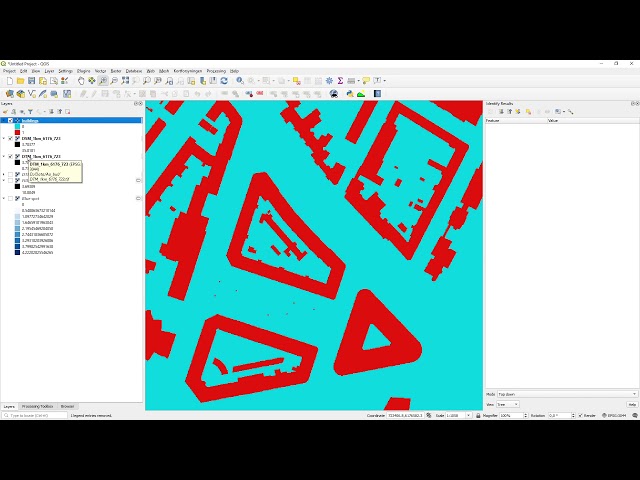
In this short video, I combine DSM and DTM data for urban surface water flow modelling. The video is the third of a series of four ...
1,842 views
5 years ago
Reverse-engineer complex metal parts effortlessly! 🛠️✨ This quick overview shows how the EinScan SP V2 3D scanner and ...
14,094 views
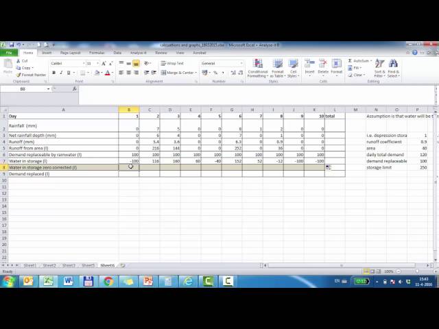
Guide for calculation of unlimited rainwater storage in excel with a constant demand.
13 views
9 years ago
35 views